World Map And Fast Travel

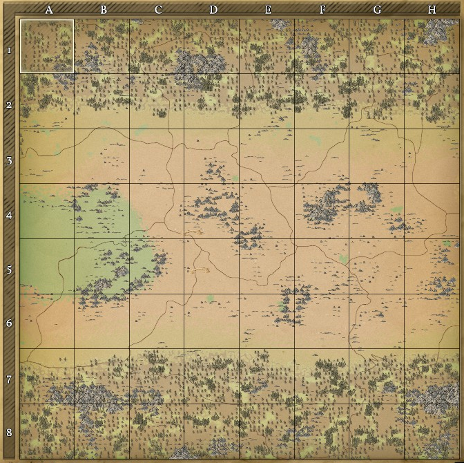
 Fareon, selected in the upper left corner, and its regions. Double-clicking a tile will show the areas contained within that region in a similar manner.
The World Map is accessed, by default, using ![]() . It features a visual representation of the planet's surface as well as a coordinate system that helps the player identify his position as well as his allies' positions in a reliable manner.
. It features a visual representation of the planet's surface as well as a coordinate system that helps the player identify his position as well as his allies' positions in a reliable manner.
| Version: | 0.6 |
| History: | 0.5 |
Coordinate System
The World Map is divided into 6 kingdoms, 384 regions and 38,400 areas (64 regions, subdivided into 100 areas, per kingdom).
The kingdoms are identified by their names: ![]() Umbril,
Umbril, ![]() Rintel,
Rintel, ![]() Darios,
Darios, ![]() Levos,
Levos, ![]() Fareon and
Fareon and ![]() Bar Hadur.
Bar Hadur.
Inside a kingdom, each region is referenced by an X coordinate ranging from A to H and a Y coordinate ranging from 1 to 8.
Inside a region, each area is referenced by an X coordinate ranging from A to J and a Y coordinate ranging from 1 to 10.
The absolute position of the selected tile can be seen right above the World Map.
Trivia: the names of the kingdoms are derived from their positions in the planet: Up, Right, Down, Left, Front, Back.

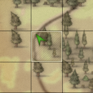
 represents the player.
 represents an ally.
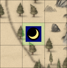
 represents an attack.
 represents taxes due.
The Navigation options are a set of shortcuts that help the player keep track of events happening in the world. The first button, a ![]() position marker, automatically sets the selected area as the one the player is currently in. The second button,
position marker, automatically sets the selected area as the one the player is currently in. The second button, ![]() two crossed swords, cycles through areas which have combat occurring inside them. This includes both PvP and PvE combats (e.g Barbarian's attacks). Finally, the third button, a
two crossed swords, cycles through areas which have combat occurring inside them. This includes both PvP and PvE combats (e.g Barbarian's attacks). Finally, the third button, a ![]() stack of coins, cycles through areas which have a
stack of coins, cycles through areas which have a ![]() Claim Block with taxes nearing expiration.
Claim Block with taxes nearing expiration.
Grids
Large grids are represented on the map based on the number of blocks they contain. If a grid crosses an area border it will be shown in both areas. Each grid size has its own icon:
Ownership


Ownership of areas that are claimed is shown on the map disregarding if the owner is your Ally, Enemy or is Neutral. In the region view, a coloured shield indicates if there are Own, Enemy or Allied claims. Green stands for own claims, Red for enemy claims and Blue for Allied claims. The shield might be split up into two parts indicating that both the claims shown are available. The area view of a region shows each individual claim, where the Green-Red-Blue scheme occurs again. Claims also show the personal banner of the player who owns the claim, and moving the cursor over the claimed area, it will show the area name and the owner of the area itself.
Fast Travel
The Fast Travel is a feature that allows, as the name says, to travel long distances in short periods of time. In order to use it, press the Fast Travel button and then select the area you want to go to. A confirmation text will ask if you really wish to fast travel to the selected area. After accepting, you'll get teleported directly to the requested area.
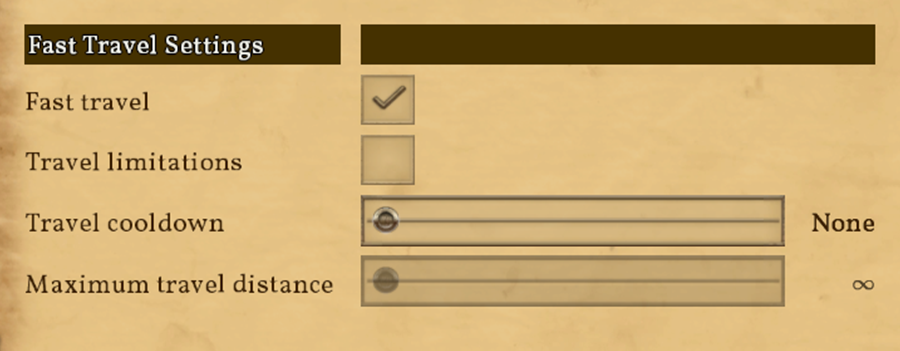
Fast Travel has different settings that can be defined in the advanced options regarding your world. In these settings, you can set a fast travel cooldown, fast travel max distance, etc.

Available Settings:
- Fast Travel: Enables or disables the Fast Travel feature.
- Travel Limitations: If checked, allows players to only travel by roads and through allied claimed areas. Sections of road claimed by enemies will be blocked.
- Travel Cooldown: Sets a cooldown to prevent players from fast traveling too often. This setting is multiplied by the number of areas traveled.
- Maximum Travel Distance: Sets the maximum number of areas that players can traverse each time using Fast Travel.


